Cape Fear River
34 mi southeast · US Army Corps of Engineers
Located in the tobacco country of eastern North Carolina on the improved channel between Wilmington and Fayetteville, the facilities are equipped for day-use, boating and picnicking.
Outdoors
National forests, parks, lakes and recreation areas with hiking trails near Fayetteville, closest first.
Good to know: Carry more water than you think you need, check the managing agency’s page for trail closures and fire restrictions, and start early on hot days.
34 mi southeast · US Army Corps of Engineers
Located in the tobacco country of eastern North Carolina on the improved channel between Wilmington and Fayetteville, the facilities are equipped for day-use, boating and picnicking.
43 mi north · US Army Corps of Engineers
B. E. Jordan Dam and Lake is located near the center of North Carolina with a large population base in a 75-mile radius of the project.
48 mi north · US Army Corps of Engineers
This recreation area is part of B. Everett Jordan Lake
Map of 16 places loads as you scroll.
Located in the tobacco country of eastern North Carolina on the improved channel between Wilmington and Fayetteville, the facilities are equipped for day-use, boating and picnicking.
B. E. Jordan Dam and Lake is located near the center of North Carolina with a large population base in a 75-mile radius of the project.
This recreation area is part of B. Everett Jordan Lake
The US Army Corps of Engineers and the State of North Carolina would like to welcome you to Falls Lake.
Canebrake Horse Camp lies in the Badin Lake Recreation Area, a hub for outdoor activities in central North Carolina's Uwharrie National Forest. The facility is a scenic and restful overnight spot with both single and double campsites.
Arrowhead Campground lies in the Badin Lake Recreation Area, a hub for outdoor activities in central North Carolina's Uwharrie National Forest. The variety of sites in the campground offer a comfortable stay for both RV and tent campers.
Badin Lake Campground borders the lakeshore and sits within a shaded forest, offering a year-round retreat for swimmers, boaters and anglers in central North Carolina's Uwharrie National Forest.
Badin Lake Group Camp offers a fun, relaxing place for clubs, families and other groups to rest and play in the Uwharrie National Forest of central North Carolina.
The refuge was established on March 17, 1939 to provide habitat for migratory birds, to demonstrate sound management practices that enhance natural resource conservation, and to provide wildlife-oriented recreation opportunities.
Cedar Point Campground and Recreation Area is located in eastern North Carolina at the junction of the White Oak River and the Bogue Sound, immediately adjacent to the Swansboro Inlet.
Located in the Neuse River Recreation Area in eastern North Carolina, Flanners Beach Campground is situated on a bluff overlooking the scenic Neuse River and within a half-hour drive from the Atlantic Ocean and Intracoastal Waterway.
North Bend Park is located on John H. Kerr Reservoir, a 50,000-acre lake that extends 39 miles up the wooded, cove-studded shoreline of the Roanoke River in Virginia and North Carolina.
John H. Kerr Dam & Reservoir, also known as Buggs Island Lake, is a 50,000-acre lake extending 39 miles up the Roanoke River along 800 miles of wooded, cove-studded shoreline in Virginia and North Carolina.
Rudds Creek Park is located on John H. Kerr Reservoir, a 50,000-acre lake that extends 39 miles up the wooded, cove-studded shoreline of the Roanoke River in Virginia and North Carolina.
Oyster Point Campground is located on the banks of the Newport River, near the town of Newport, NC. The campground is just a short drive to the beaches of Atlantic Beach, NC and other coastal fishing destinations.
Roanoke River NWR was established in 1989 to protect and enhance wooded wetlands consisting of bottomland hardwoods and swamps with high waterfowl value along the Roanoke River.
Distances are straight-line miles from downtown Fayetteville. Listings come from Recreation.gov’s federal recreation database; check each official page for hours, fees, fire restrictions and closures before you go.
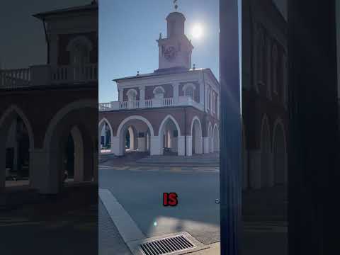
THINGS TO DO · YOUTUBE SHORT
A local activity Short shared by Brycen Erdody.
Watch on YouTube ↗
THINGS TO DO · YOUTUBE SHORT
A local activity Short shared by Antoinette Michelle.
Watch on YouTube ↗


Cape Fear River (US Army Corps of Engineers), about 34 miles southeast of Fayetteville as the crow flies. Next are B. Everett Jordan Lake (43 mi) and Crosswinds Campgrounds (48 mi).
Based on Fayetteville’s average highs, October–April. Conditions at higher elevations can be much cooler.
Federal agencies including US Army Corps of Engineers, USDA Forest Service, Fish and Wildlife Service. Each listing links to its official page for hours, fees, closures and current conditions.